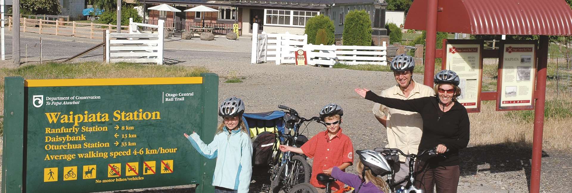
When starting out from Lauder your Night 2 can stay in Waipiata (56km), the aim should be to make the most of the Poolburn Gorge, enjoy the ride across the Ida Valley, explore Oturehua and then cycle the Big Sky country of the Maniototo Plain.
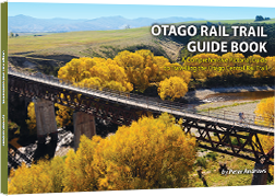
3 Day Itinerary Clyde to Middlemarch
Our Recommendation: Day 1/Night 1 (start Clyde, finish Lauder)
Your Journey on Day 1
Click on the tabs below for info on the trail and distances between them.
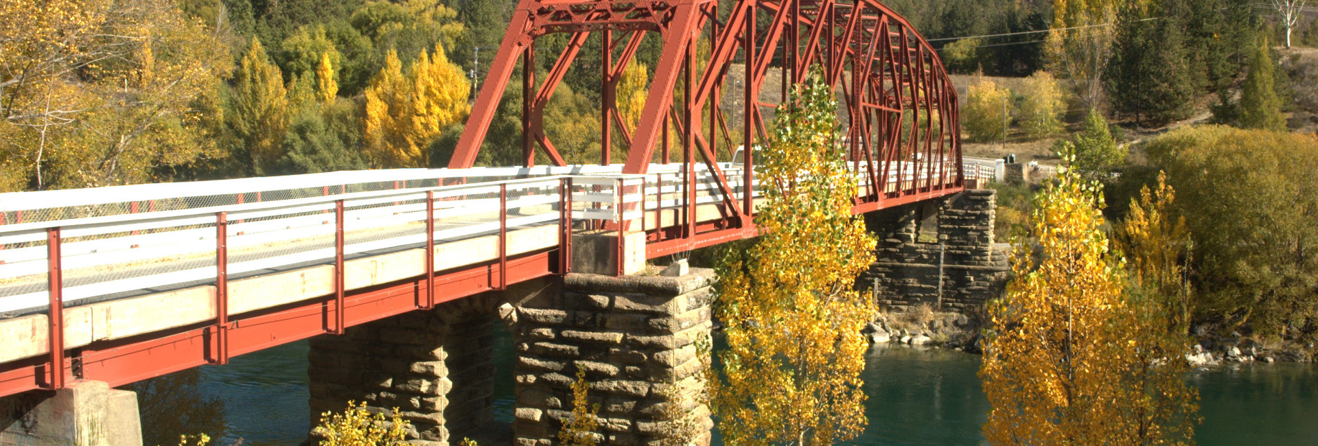

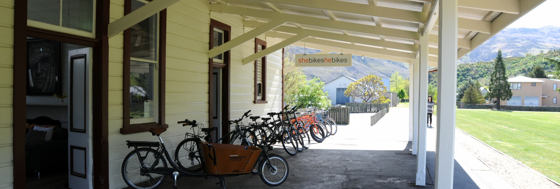
Clyde
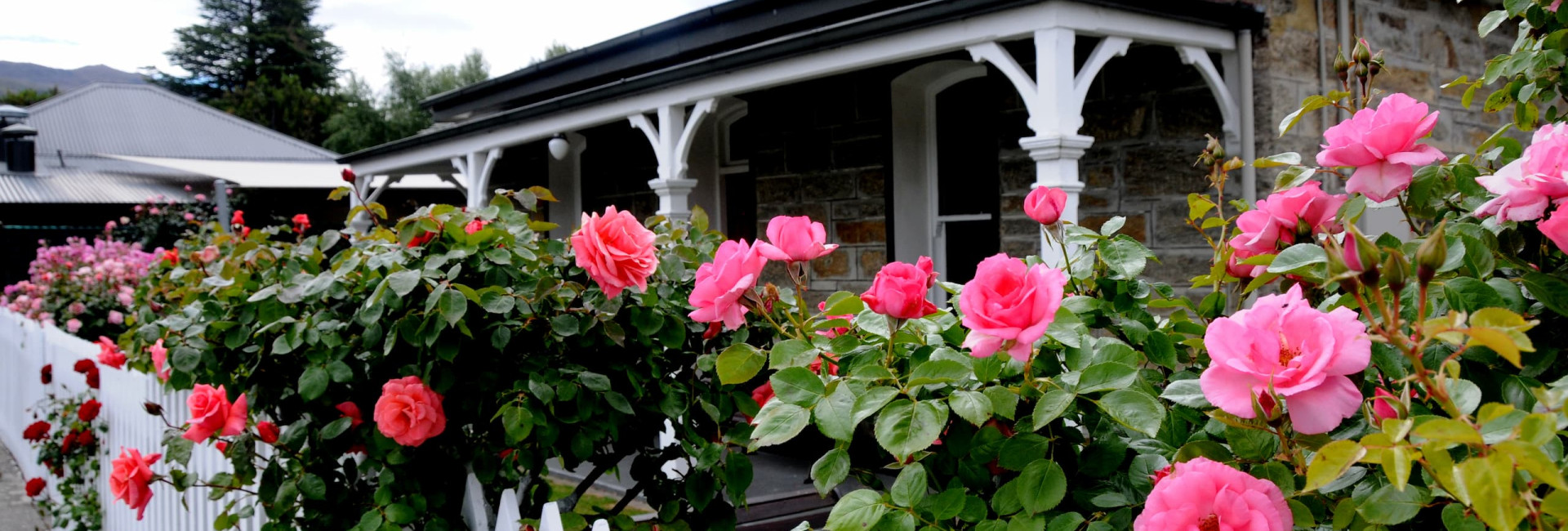
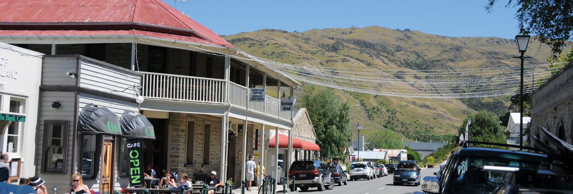
Clyde can be the start or finish of the Otago Central Rail Trail, and while it may be a small, it is a town big on attractions.
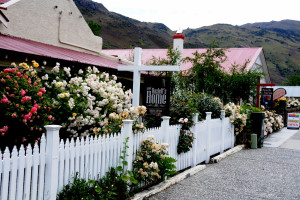
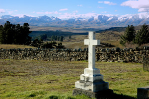
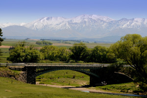
It is impossible not to be captivated by Clyde’s main street of 1800s gold rush buildings sympathetically repurposed as accommodation, restaurants and cafes, specialty shops and art galleries. Guided walks and cycle paths go past many lovely gold rush era cottages with long established gardens of rambling roses. In the 1980’s Clyde was thrust from a sleepy hollow into the public eye with the lead up and building of the Clyde Dam, NZ’s third largest hydroelectric dam. For those with a taste for huge scale engineering, follow the public footpath beside the road to the first lookout - 1km from town -- for views of the dam and power station. The dam also provides irrigation water to the area’s thriving orchards and vineyards. A further 500m up the hill, a second lookout provides commanding views over Lake Dunstan, the powerhouse, the Clutha River and Clyde.
Clyde Holiday Park
Tagged as: Tourist Park / Camping, BackpackersClyde Holiday Park – situated in the heart of sunny Central Otago come to Clyde and enjoy everything our part of New Zealand has to offer
Rates:Pricing starts from $20 per adult
More Info
Dunstan House Clyde & Cafe
Tagged as: Bed & Breakfast, HistoricDunstan House was built in 1898 in a grand statement of opulence as the very first two storied building in Central Otago. Located on the main street of historic Clyde it was, and remains, an iconic local building, instantly recognisable and rich in history.
Rates:A full range of rates is available to ensure all travellers are able to enjoy the comforts of Dunstan House.
Rooms with shared bathroom facilities are available from, $130
Ensuited rooms are available from $230
The Suite, with its own private lounge and ensuite is available from $265
More Info
Hartley Arms Accommodation
Tagged as: Bed & Breakfast, Historic, Self - ContainedHeritage accommodation in a quiet private setting on Clyde's main street in close proximity to a choice of cafes, cinema and general store.
Rates:Adults - from $80.00 per person per night
$140.00 per couple
Children(12 & under) - $50.00 per night
Open from early September until early May
More Info

Lavender Drive Bed & Breakfast
Tagged as: Bed & BreakfastYour Hosts Clare and Tony Welcome you to their one hectare modern Central Otago schist stone-clad Bed and Breakfast, close to Clyde / Alexandra, with easy access to the Rail Trail and a host of other activities - golf, boating, tramping, etc. plus several good local cafes, restaurants and wineries. We offer you relaxing accommodation in peaceful, scenic surroundings. No dogs, thank you.
Rates:1 x King bedroom with ensuite $170 per night
1 x Queen bedroom $150 per night
1 x Twin bedroom $140 per night

Olivers Lodge and Stables
Tagged as: Bed & Breakfast, HistoricProviding a luxurious Central Otago accommodation experience within heritage listed buildings from the late 1800s.
Olivers Lodge & Stables transports you to a quieter, calmer time and place
Rates:From $300 to $565 per night inclusive of freshly baked hot breakfast served in our stunning schist walled dining room or al fresco in Olivers private courtyard.
More Info
Post Office Cafe & Post Masters Accommodation
Tagged as: Bed & Breakfast, HistoricPost Masters Accommodation offers 3 double bedrooms, refurbished to retain the quietly elegant and comfortable surroundings of the stone building.
Rates:$95 Queen or Twin, $125 Queen ensuite
Full house discount for groups of six
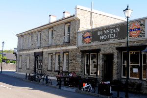
Dunstan Hotel
The Dunstan Hotel was built in 1904. A hearty meal or a quiet drink.
35 Sunderland Street. Ph: 03 449 2817
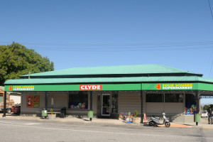
Four Square
Supermarket, groceries, beer, wine, foods, discount deals, local stores, lotto.
5 Fraser Street. Ph: 03 449 2718
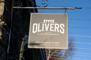
Oliver's Restaurant
There is a craft brewery (The Victoria Store Brewery), a bakery, deli and cafe.
34 Sunderland Street. Ph: 03 449 2805
Paulina's Restaurant
Located just besides Clyde Cinema.
6 Naylor Street. Ph: 03 449 3089

Post Office Cafe & Bar
Expect a warm welcome in these enchanting historic buildings and enjoy an appetizing snack or a delicious meal.
2 Blyth Street. Ph: 03 449 2488

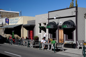
The Bank Cafe
Tasty food, great coffee. Inside and outside options for hungry and thirsty cyclists.
31 Sunderland Street. Ph: 03 449 2955
The Clyde Dairy Cafe & Takeaways
The Dairy is a Clyde institution and is a favorite stopping point for many a passing traveler and locals alike. Takeaways also available.
18 Sunderland Street. Ph: 03 449 2799

Anniversary River Track
If you have the time, the Anniversary River Track that begins in Clyde and finishes in Alexandra is a great way to spend some time by bike or foot. It is sign posted 300 meters along Earnscleugh Road. Maps are available from the Alexandra information centre. The Clutha River never fails to impress. The track hugs the banks of the Clutha River most of the way to Clyde. There are many good picnic areas shaded by wilding willow trees.

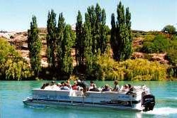
Clutha River Cruises
This journey is on a pontoon craft, which is capable of seating 17 adults comfortably. This cruise explores the Roxburgh Gorge on the Clutha River that will take you back to the European and Chinese gold rush that happened on the banks of the Clutha River. Remains of miners cabins are hidden by Matagouri, Thyme, and spectacular schist rock. These tours give you a historic experience, which takes 75 minutes covering 50 km of the stunning Central Otago scenery. Customers can look forward to a commentary of the history of the area, with some of the focus being on places of interest such as the miner’s huts, rock shelters and of course the legendary Doctors Point Gold Mine. Ph: 022 068 3302
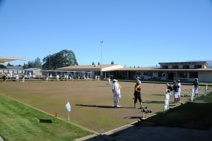
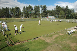
Clyde Bowling Green
Clyde Bowling Club was established back in 1913. There is an inside rink, which you can play at all times.
Sunderland Street and Whitby Street. Ph: 03 449 2838
Clyde Cinema
42 seat Cinema. Watch in comfort. Fully licensed with food and wine available.
Check what's on now. www.clydecinema.co.nz
6a Naylor Street. Ph: 03 449 2379
Clyde Golf Course
The Dunstan Golf Club. Green Fees $25.00 for 18 holes.
Sunderland Street. Ph:03 449 2729

Clyde Historical Museum Briar Herb Factory Complex
This historical museum houses a great collection of memorabilia relating to a history from Run Holding to the Dunstan Gold Rush. You will find domestic articles, records, books and photographs. Nearby is the Briar Herb Factory Museum Complex which displays the factory and machinery in its historic form. Open 3pm - 5pm Tuesday - Sunday (Closed May - August)

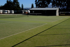
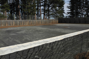
Clyde Tennis Courts
Clyde Tennis Club is established back in 1877. All-weather surface.
Sunderland Street. Ph: 027 600 3236
Friday night doubles 6.00 pm Sunday Social Doubles 9.00 am / (10.am in Winter)
Wednesday Night Ladies 5.30 pm.
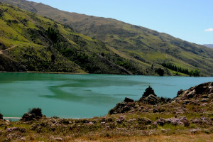
Fishing at the Lake Dunstan
Lake Dunstan was formed as a result of the Clyde Dam. Easy access is available to most parts of the lake. For further information.
Shopping
There are many great shops in Clyde. Worth visiting.
- Touch Yarns - New Zealand wool products and gifts inspired by local scenery. 19 Sunderland St.
- Purveyors - This delightful gallery has locally made wine, jewellery, clothing and Rail Trail souvenirs for sale. 27 Sunderland Street
- Art in the Dark - A small craft shop that has paintings and craft work by local artists. Sunderland Street and Naylor Street.
- Sausage Ally - This butcher provides an excellent supply of meaty goodness. Open Fridays 8am - 5pm. 27 Sunderland Street. Ph: 03 449 3048.
- The Stonehouse - A range of gourmet pickles, sauces, fruit chutneys, alcohol and liqueur enhanced fruit preserves and fruit liqueur toppings. Open 9am - 6pm December - March 81 Springvale Road.
The Clyde Dam
The Clyde Dam is easily viewed from the town. If you fancy a walk, follow the public footpath beside the road to the first lookout which is about 1km from town. This lookout looks over the dam and power station. A further 500m walk up the hill you will find the second lookout which views Lake Dunstan, the powerhouse, the Clutha River and Clyde township.

Walk Around Historic Clyde
The township of Clyde was typical of many of the gold mining settlements. A surprising number of original buildings from the gold mining era are still as true as the day they were built. Get the leaflet called 'Walk Around Historic CLYDE' which give you all information of historical buildings in the township. You can get it at the Bank Cafe or Dunstan House.
Clyde Dam to Alexandra 10km Road Races
Organised by: Alexandra Harriers & Walkers Club
Contacts: John Watson 448 5969 / John Thompson 448 7244
When: Mid - August
Entry forms available early July from local sports stores, our website or by contacting Jill Scott 448-9146.
Web site: www.alexandraharriers.orcon.net.nz
Easter Harvest Wine and Food Festival
This is the premiere event on Clyde's calendar and attracts thousands of visitors from near and far - some from very far!
Usually, all of the regions wine producers are represented and you can sample and purchase their fine products. There is food too - not just any food - but really special delectables to tempt your palate.
With great music and dozens of stalls there is something for everyone.
Where: In the main street of Clyde
When: Easter Sunday
Mid-Winter Market
Each year, in mid-winter, the Clyde Playcentre organsies a market in the Memorial Hall, to raise funds for its activities.
There are many stalls offering such things as food, arts and crafts, books and the like.
We'll take some photos next winder so that you can see what it's all about!
Where: Memorial Hall, just along from the 4 Square store.
When: Mid-winter
Contact: Carole Haig 449 2557
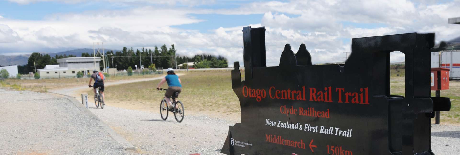
Clyde to Alexandra Distance: 8 km
- From the Clyde Historic Precinct, along greenways and then through the State Highway 8 Daphne Hull Underpass will get you to the Clyde Trailhead. In the underpass do pause to admire the fantastic Bruce Potter mural lining the walls.
- Free long term parking is available at the Trailhead. There is also a well-maintained public toilet block.
- A highlight on the Clyde-Alexandra section is the 109 metres long and 9 metres tall Muttontown wooden trestle viaduct.
- After the Muttontown Viaduct you will see one of the last remaining signal arms on what was the Otago Central Railway.
- On the outskirts of Alexandra, the Rail Trail runs parallel to the greens and fairways of the Alexandra Golf Club 18 hole course.
Alexandra to Chatto Creek Distance: 17 km
- Leaving Alexandra, the Rail Trail crosses State Highway 85 to the Manuherikia Bridge No. 3.
- Next highlight is Galloway Straight where part of the railway station building remains. This makes a popular stopping and meeting point for cyclists and support vehicles.
- At the end of the straight is the first of the Rail Trail’s red painted Line Gangers’ Sheds. Inside each is a large information panel about the local area.
- Keep an eye out for colourful lupines flowering over the spring and summer seasons.
- Next up, the trail goes over the impressive 120 metres long and 14 metres high Manuherikia No. 2 Bridge. From the bridge you can try spotting trout or on a hot summer’s day, take a dip in the river.
- Leaving the Manuherikia River you now follow the sublime Chatto Creek. Willows line the stream to the left and depending on the season, you will see and smell thyme spread amongst schist rock formations on the right.
- Chatto Creek Tavern will draw you in with their fine food and friendly service.
Chatto Creek to Omakau Distance: 12 km
- This section starts by crossing State Highway 85 from the Chatto Creek Tavern to an information kiosk and DOC toilet.
- The trail soon ‘S’ bends up Tiger Hill. The steepest part of the Otago Rail Trail, this gradual 1 in 50 incline made it possible for the trains to climb up Tiger Hill.
- Have a well-deserved rest at Tiger Hill Gangers’ Shed to enjoy spectacular mountain views.
- After riding under the State Highway 8 overbridge it's a gentle downhill run to Omakau, once Central Otago’s largest stock loading railway station.
Omakau to Lauder Distance: 7 km
- Between Omakau and Lauder the Rail Trail passes through the Matakanui Valley where pivot irrigators have turned this into productive deer, sheep and cattle country.
- The snow-capped Dunstan Mountains can be easily viewed to the nor-west.
- The distinctive Hawkdun Mountain Range is also visible to the north.
- The Raggedy Range is to the south east of the trail.
- In Lauder you can breathe some of the world’s cleanest, most pollution-free air.


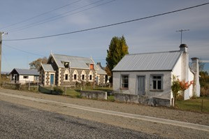
Lauder
Lauder has one of the most clean and pollution-free atmospheres in the world
Named after the Berwickshire town of Lauder in south eastern Scotland, Lauder was very much a railways township. During construction of the Otago Central Railway, ballast was quarried nearby. This is the coarse rock used as bedding for sleepers and metal rails. Lauder is also known for the National Institute of Water and Atmosphere Research Centre (NIWA), located a few hundred metres out of town. Here scientists measure climatic features and study issues such as climate change and ozone depletion. Lauder has one of the most clean and pollution-free atmospheres in the world. The Rail Trail crosses State Highway 85 at Lauder making it a convenient meeting point for cyclists and walkers and support vehicles.
Info
Population: 12
Big Sky Cottage - Lauder
Tagged as: Self - Contained, Historic, Bed & BreakfastWelcome to Big Sky Cottage, a beautiful character 1930s mud brick house, providing self contained accommodation in Lauder.
Rates:2 people in one room $175 per night
2 people in two rooms $275 per night
3 people in two rooms $295 per night
4 people $295 per night.

Lauder School B&B
Tagged as: Bed & Breakfast, HistoricLauder School B&B offers a range of tastefully-decorated accommodation at the historic Lauder Railway School. Situated right on the Rail Trail in Lauder it makes an ideal first or last night of a Rail Trail adventure or fantastic base for a family celebration or wedding. Sleeps up to 22 guests.
Rates:From $70 - $190 per night including a generous continental breakfast
More InfoThe Lauder Hotel
Originally built as the Railway Hotel, it was turned 180° to face the road as use of the railway declined. Be sure of great food and friendly hospitality.
Ph: 03 447 3706.

The Stationside Cafe
Shirley and her team pride themselves on preparing appealing delicious and nutritious meals, on site daily.
Ph: 03 447 3580.

National Institute of Water and Atmosphere Research Centre (NIWA)
National Institute of Water and Atmosphere Research Centre (NIWA), which is located a few kilometres out of town, measuring climatic features and studying issues such as climate change and ozone depletion. Lauder has one of the most clean and pollution-free atmospheres in the world. Ph: 03 440 0429

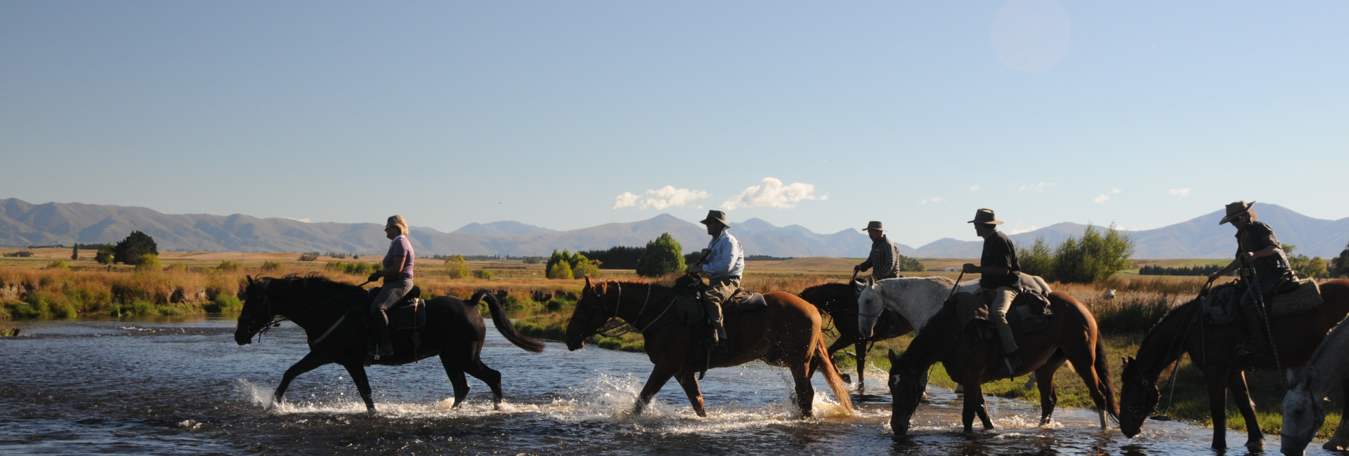
The Poolburn Gorge
The Poolburn Gorge is one of the most dramatic sections on the Rail Trail. For this reason it is recommended that cyclists pack snacks and allow for a stop to give them a chance to soak up the stunning scenery of the gorge. A torch is recommended for the tunnel. Take the time to get off your bike and view the Viaduct, the tunnels and the bridge structures.

Our Recommendation: Day 2/Night 2 ( start Lauder, finish Waipiata )
Your Journey on Day 2
Click on the tabs below for info on the trail and distances between them.
Lauder
Lauder has one of the most clean and pollution-free atmospheres in the world
Named after the Berwickshire town of Lauder in south eastern Scotland, Lauder was very much a railways township. During construction of the Otago Central Railway, ballast was quarried nearby. This is the coarse rock used as bedding for sleepers and metal rails. Lauder is also known for the National Institute of Water and Atmosphere Research Centre (NIWA), located a few hundred metres out of town. Here scientists measure climatic features and study issues such as climate change and ozone depletion. Lauder has one of the most clean and pollution-free atmospheres in the world. The Rail Trail crosses State Highway 85 at Lauder making it a convenient meeting point for cyclists and walkers and support vehicles.
Info
Population: 12
Big Sky Cottage - Lauder
Tagged as: Self - Contained, Historic, Bed & BreakfastWelcome to Big Sky Cottage, a beautiful character 1930s mud brick house, providing self contained accommodation in Lauder.
Rates:2 people in one room $175 per night
2 people in two rooms $275 per night
3 people in two rooms $295 per night
4 people $295 per night.
Lauder School B&B
Tagged as: Bed & Breakfast, HistoricLauder School B&B offers a range of tastefully-decorated accommodation at the historic Lauder Railway School. Situated right on the Rail Trail in Lauder it makes an ideal first or last night of a Rail Trail adventure or fantastic base for a family celebration or wedding. Sleeps up to 22 guests.
Rates:From $70 - $190 per night including a generous continental breakfast
More InfoThe Lauder Hotel
Originally built as the Railway Hotel, it was turned 180° to face the road as use of the railway declined. Be sure of great food and friendly hospitality.
Ph: 03 447 3706.
The Stationside Cafe
Shirley and her team pride themselves on preparing appealing delicious and nutritious meals, on site daily.
Ph: 03 447 3580.
National Institute of Water and Atmosphere Research Centre (NIWA)
National Institute of Water and Atmosphere Research Centre (NIWA), which is located a few kilometres out of town, measuring climatic features and studying issues such as climate change and ozone depletion. Lauder has one of the most clean and pollution-free atmospheres in the world. Ph: 03 440 0429
The Poolburn Gorge
The Poolburn Gorge is one of the most dramatic sections on the Rail Trail. For this reason it is recommended that cyclists pack snacks and allow for a stop to give them a chance to soak up the stunning scenery of the gorge. A torch is recommended for the tunnel. Take the time to get off your bike and view the Viaduct, the tunnels and the bridge structures.
Lauder to Oturehua Distance: 23 km
- After crossing State Highway 85, the trail takes you over the Manuherikia Bridge No. 1. An impressive curved concrete structure 110.6 metres long and 14 metres tall.
- Approximately 10 metres before entering the Poolburn Tunnel No. 2, on the left is a path with a safety rail that takes you to remnants of the Linemen’s Base used during rail construction in the Poolburn Gorge.
- It is hard not to feel sympathy for the linemen who built the railway using hard physical labour, wheelbarrow, pick, shovel, horse and cart.
- Returning to the trail, switch on your torch and walk your bike through the Poolburn Tunnel No. 2. At 229 metres it’s the Rail Trail’s longest.
- Further up the gorge is the Poolburn Tunnel 1. Because the railway was built from Middlemarch, this was the first of the two Poolburn Gorge tunnels.
- Back into daylight it’s only a short distance to the 37 metre high Poolburn Viaduct, arguably the most imposing structure on the Rail Trail.
- The viaduct’s huge rock piers and abutments were quarried from local outcrops and crafted by stone masons to a standard seldom seen today.
- Be sure to read the information panel at the eastern (Oturehua) end of the viaduct.
- Descending the slopes of this northern part of Raggedy Range, you are treated to brilliant views of the spectacular Hawkdun Mountain Range and North Rough Ridge.
- After leaving the Poolburn Gorge, and having possibly caught a glimpse of the swept-wing New Zealand native falcon (karearea), you reach the Auripo Station where today nothing much remains.
- The Ida Valley opens up in front of you. Known for its extremely harsh climate, during winter months, the valley floor is often cloaked in thick fog. .
- Be sure to stop to take a look at the now privately owned Ida Valley Railway Hotel. This historic building is easily viewed from the trail or public road.
- On the outskirts of Oturehua the trail crosses Ida Valley Road to the Idaburn Dam. During cold winters the dam can freeze to a depth suitable for curling competitions and when conditions are perfect, a curling bonspiel.
- Just along from Idaburn Dam and back across the Ida Valley Road is the clearly signposted Hayes Engineering Works and Homestead (look for the windmill). Here Ernest Hayes forged many labour-saving inventions with his most famous being the Hayes Wire Strainer. Perfected in 1924, it is still used on fences throughout the world. The historic mud brick buildings are very photogenic.


Oturehua
Home of the world famous fence strainer and NZ’s oldest continuously operating general store
Originally called Rough Ridge, the arrival of the railway in 1907 saw this Ida Valley township change back to its Maori name ‘Oturehua’ (meaning The Sun God). It was also the site of the biggest construction camp on the Otago Central Railway. The land around Oturehua was a source of silcrete, an extremely hard rock Maori crafted into blades to hunt and cut up Moa. On the southern outskirts of town is the historic Hayes Engineering Works established in 1895 and where millwright turned engineer, Ernst Hayes developed the Hayes Permanent Wire Strainer that is used to this day throughout NZ and much of the world. Another Oturehua must-see is Gilchrist's Store, NZ’s oldest continuously operating general store. Opened in 1899, in 1902 the store moved next-door to its current location where brands of yesteryear are displayed alongside today’s favourites. North of the township a few hundred metres detour up Reef Road takes you to the Golden Progress Mine where Central Otago’s last poppet head straddles one of numerous shafts sunk to reach elusive gold-bearing quartz rock.
Info
Population: 27
Braeside Cottage
Tagged as: Bed & Breakfast, Self - Contained, FarmstayPreviously used as a shearer’s quarters, the cottage has beautiful views over the valley – sunrises over Rough Ridge, the distinctive Hawkduns to the North, and stunning evening skies over Blackstone Hill in the west.
Rates:Dinner and Breakfast are provided at Braeside, and are included in your room rate.
More Info
Crow's Nest Accommodation
Tagged as: Tourist Park / Camping, Backpackers, Self - ContainedJust 100 m. from the Otago Central Rail Trail. Multiple Accommodation options in Oturehua.
Rates:Backpacker, cabin, & tent site from $15 to $90 p/p a night.
Doubles rate for cabins $110 - $145 p/night
Child rates apply – 10 years and under.
More Info
Gilchrists Store & The Old Shop B&B
Tagged as: Bed & Breakfast, HistoricThe Otago Central Rail Trail has some wonderful accommodation experiences. As the name suggests “The Old Shop B & B” was once a store, the original Gilchrists Store in fact that was opened in the 1890’s. What was 'out the back of the shop' now offers comfortable accommodation for up to six people...
Rates:2 persons $70.00 per head, 3 to 6 persons $65.00 per head
Includes continental breakfast.

Oturehua Railway Hotel
Tagged as: Hotel, HistoricWhether you are riding or walking the Central Otago Rail Trail or driving through the Ida Valley stop for a while and enjoy the stunning views of Rough Ridge and the Hawkdun Ranges from our large family beer garden or alternatively warm up by our cosy fire on our comfortable couches.
Rates:$60.00 per person for two people or more. Single rate $75.00.
This rate includes a continental breakfast.
More InfoGilchrist's Oturehua Store
This is a working historical general store and has been operating continuously under the name of "Gilchrist" since 1902.They stock fresh fruit and vegies, groceries, pies and sandwiches, ice-creams, lollies, Grahame Sydney prints, and much more.

Hayes Engineering Cafe
There is a cafe in one of the historical mud brick buildings which is part of Hays Engineering Works and Homestead. Closed over winter.

Oturehua Railway Hotel
Situated half way along the Rail Trail we are your ideal stopover and children are welcome. A full range of meals and snacks are available, specialty coffees and Central Otago wines.

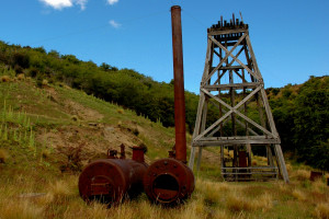
Golden Progress Mine
A good opportunity to stretch the legs, the Golden Progress mine can be found ten minutes off the Rail Trail by following the sign-post on the town’s outskirts on the way to Wedderburn. Note that the mine is normally closed to the public in spring time due to lambing.
Hayes Engineering Museum
Hayes Engineering Works was an important hub for New Zealand innovation, with a variety of tools and farm equipment having been invented there. The inventor, Ernest Hayes, is most notable for inventing the Hayes Wire Strainer which is still used on fences throughout the world to this day. See the Engineering Works that still comes to life, or discover the fascinating story of the Hayes family as you wander through the restored homestead.
Contact: ph 03 444 5801
Email hayes@heritage.org.nz

Oturehua Tennis Courts
There are community tennis courts on the edge of town which are available to the general public.

Oturehuas Gilchist Store
Visit Oturehuas Gilchist Store. This historic building in the centre of Oturehua town is one of the best known stores in Central Otago. Built in 1899 this store is a rare delight for any nostalgia enthusiast, successfully merging the old and the new. The shelves boast memorabilia such as the original telephone exchange, an antique bacon slicer, tinned coffee and food from the late 1800’s. Present day goods are also sold.

Bonspiel
Curling on the Ida Burn Dam can occur during the winter months if the ice is thick enough. The dam hosts the ancient curling Bonspiel tournament.
Ph: 03 444 9878
Hays Engineering & Homestead 'Live' Operating Days
Experience the remarkable belt- driven Hays Engineering Works in operation wander the grounds and the view the interior of the grand homestead.
Where: 39 Hays Road, Oturehua
Guided tours of the Works (45 minutes)
On the hour from 10.30am - 3.30pm
Oturehua to Wedderburn Distance: 12 km
- Be sure not to leave Oturehua without visiting Gilchrist Store that’s been in business since 1899.
- On Oturehua’s northern outskirts is the first of two 45º South Latitude markers on the trail to Wedderburn. 45 south puts you halfway between the Equator and South Pole.
- Where the trail crosses Reef Road there’s a short and worthwhile detour to the historic Golden Progress Mine where Otago’s only remaining ‘poppet head’ straddles the deep shaft used for bringing gold-bearing ore to the surface.
- After a gradual climb up Rough Ridge, you will come to a second 45º South Latitude marker.
- Further on, take a breather at Seagull Hill Gangers’ Shed.
- On the top of the ridge you’ll have reached 618 metres above sea level. And that means you’ve conquered the highest point of the Otago Central Rail Trail.
- An easy slope takes you to the tiny town of Wedderburn boasting a 9-hole golf course and quaint country pub.
- On leaving Wedderburn, the trail crosses SH 85 to the iconic Wedderburn goods shed made famous by eminent Central Otago artist, Grahame Sydney.
Wedderburn to Ranfurly Distance: 13 km
- The trail from Wedderburn to Ranfurly is pretty much a downhill cruise across the vast Maniototo Plain surrounded by the Mt Ida, Rough Ridge, Hawkdun and Rock and Pillar Ranges, as well as the Kakanui Mountains. During winter and spring, these mountains are mostly snow-covered in winter and spring.
- Two gangers’ sheds along this section of the Trail provide shelter and interesting reading about the local area and what lies ahead on the Rail Trail.
- Ranfurly is the districts main rural supply and services centre and is also recognised for its many Art Deco buildings. For Rail Trailers it may come in handy to know Ranfurly also has a modern hospital and on the main street, a large pharmacy.


Ranfurly
The thriving rural supply and services centre with the added attraction of art deco buildings
Named in honour of the Fifth Earl of Ranfurly, NZ’s 13th Lieutenant Governor, Ranfurly is the busy rural supply and services centre for a vast farming region between Wedderburn and Hyde and spanning from the Hawkdun, Ida and Kakanui Ranges to the Rock and Pillar and Lammerlaw Ranges. Ranfurly owes its importance to the Otago Central Railway crossing the Maniototo Plain rather than making a dogleg to Naseby, then the district’s biggest town. It was also decided Ranfurly would be the line’s main engine, freight and passenger change over station. Further rubbing salt into the wounded pride of Naseby townsfolk, many of their business buildings were relocated to Ranfurly. Perhaps this was behind a series of suspicious fires in the early 1930s that destroyed many Ranfurly buildings. If it was, it backfired as the architect in charge of rebuilding followed the then fashion of art-deco designs to create Ranfurly’s reputation as NZ’s Rural Art Deco Centre. Along with the only hospital on the Rail Trail, Ranfurly offers a large pharmacy, i-Site, Four Square store, car hire, petrol station and a variety of cafes, beverage and accommodation services. Next door to the Ranfurly Station building, the Centennial Café is now the Rural Art Deco Gallery where in a series of rooms sets the glamour and glitz of this stylish era is brought to life.
Info
Population: 663
Railway Retreat & Railway Cottage
Tagged as: Motel, Self - Contained, HistoricOur accommodation is located at 5 Thomas Street in Ranfurly. (Opposite the Police Station).
Railway Cottage was built in 1921 and can accommodate up to 6 people in either double or twin share format.
Railway Retreat, built in 2019, sits behind Railway Cottage and features 3 fully self contained rooms which can be set up as a double room or twin share.
Rates: More Info
Ranfurly Holiday Park Motels & Cabins
Tagged as: Self - Contained, Motel, Tourist Park / Camping, EnsuiteCome and relax in our friendly country holiday park situated in the heart of the Maniototo. A great central base for the Rail Trail, fishing, hunting, 4WD tours, horse trekking and rural art deco. We have a range of facilities including self-contained motel units, cabins, power and non-power sites. Family friendly with a children's playpark including jumping pillow. We are dog friendly too. We look forward to welcoming you soon.
Rates:All base prices are per night for 1 or 2 people:
*Children are 2-14 yrs. Infants under 2 free
Studio Motel $150 per night - $35 extra adult and $26 extra child
One-Bedroom Motel $165 per night - $40 extra adult and $28 extra child (wheelchair accessible)
Cabins $72 per night - $25 extra adult and $18 extra child
Powered sites $45 per night - $18 extra adult and $12 extra child
Tent sites $40 per night - $17 extra adult and $12 extra child
Please note: Prices and minimum night stays may vary at peak times.
More Info
Ranfurly Lion Hotel
Tagged as: Historic, HotelLocated on the Central Otago Rail Trail on Ranfurly’s Main Street directly across from the Visitor Center, this Historic Hotel Built in 1934 the ‘Art Deco Era’ offers affordable Accommodation & Restaurant/Café meals surrounded by warm inviting hospitality.
Rates:$75 single share up to $140 for King ensuites
More Info
Ranfurly Motels
Tagged as: Self - Contained, MotelRanfurly Motels have been lovingly refurbished in Art Deco colours in keeping with the theme of the town. We are situated just 100metres from the trail in a quiet cul-de-sac.
Set on a 2 acre block of tranquil grounds with beautiful willow trees to rest under.
Studio $140 (1 – 2 people), 2-bedroom $160 (2 people) - $25 extra adult
Continental breakfast available on request.

Trout 'n' Trail B&B
Tagged as: Self - ContainedPrivate, peaceful and affordable accommodation
relax after your biking with a cold beer or wine, cook your own bbq
or short stroll to pubs restaurants and supermarket.
2 units ($120 per couple) and fully equipped house ($110 per couple)
More InfoE-Central Café
The aroma of E-Central’s coffee will bring you in, and their pleasant patio will keep you there. Quality meals and treats.
14 Charlemont Street. Ph: 03 444 8300.

Fantail Kitchen Bakery
Home-made pies and other delectable goodies.
6 Pery Street. Ph: 03 444 9307
Maniototo Four Square and Cafe
Groceries. Postal Agency.Newly opened cafe. The café is open 7am – 6pm Monday to Friday, 8am – 5pm Saturday and Sunday, and 8:30am – 5pm on public holidays. 1-3 Pery Street.

Ranfurly Lion Hotel
Open all day for casual dining and evening meals. The lounge bar has been restored to reflect the art-deco era, of the towns theme. Enjoy a beer on the sports bar or on the veranda.
10 Charlemont Street East. Ph: 03 444 9140.

Ranfurly Supermarket
Groceries, beer, wine. 24 Charlemont Street.
The Barmoral Dairy
Open 9:00 am to 9:00 pm 7 days a week over the summer season.
Tasty hamburgers, fish and chips and much more. 17 Northland St.
Art Deco Museum
Housed inside the original Centennial Milk Bar building. Displays of Art Deco furniture, arts and homeware. The Art Deco Museum also provides a gift shop. Next to the Ranfurly Information Centre.
Opening hours Tuesday to Sunday ( October to December 1-4 pm, January to May 11am - 4pm )

Browse the town
View art deco buildings and enjoy shopping.
- The Curiosity Shop - Fun vintage store with knick-knacks galore and real bargains for the avid hunter. Next to the Ranfurly Information Centre.
- The Practice - Newly opened gift gallery selling local quality Maniototo crafts, gifts and prints. Coffee is also available. Located on Northland Street.
- More Than Books - This shop has a Lotto agency, and sells magazines, gifts, cards, souvenirs, and more. Located on Charlemont Street. East.

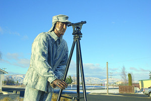
John Turnbull Thomson's Statue
John Thomson was chief surveyor of Otago. From 1856 until 1858 Thomson surveyed and explored large sections of the interior of the South Island, covering most of the southern half of the island.
Maniototo 4WD Safaris
Experience the rugged terrain of the local landscape and see historic gold mining sites.
John Mulholland Ph: 03 444 9703

Maniototo Golf Course
Maniototo Golf Club offers a 9-hole course.Tyrone Street.
Ph: 03 444 9633

Ranfurly Bowling Green
Ranfurly Bowling Club. John Street. Ph: Terry McCloy 444 9559

Ranfurly Swimming Pool
The Ranfurly Swimming Pool is open from November to early April, every day until 8.00pm. This complex provides a 30 metre long pool with a separate toddler’s pool.
John Street. Ph: 03 444 9394

Ranfurly Tennis Courts
Ranfurly tennis courts and squash courts are located within Maniototo park.

Real Dog Adventures
Kennel Tours and Rides with wonderful Alaskan Malamutes & Canadian Eskimo dogs. On the corner of SH85 and Bypass Road. 4kms from Ranfurly.
Ph: 03 444 9952

Maniototo Agricultural & Pastoral Show
A & P Shows are an important event in any rural community. Among the traditional horse and sheep events, machinery displays and, always the favourite, the Grand Parade. There’s candyfloss, a variety of food and retail stalls and, depending on the weather, a kids slippery slide. A truly rural experience!
When: 11th February 2026
Ranfurly to Waipiata Distance: 8 km
- The Ranfurly to Waipiata section of the trail is in the heart of the Maniototo Plain. The Plain's vastness and the “big sky” create an undeniable sense of serenity. “Mani-o-toto” is Maori for “Plains of Blood”. This could be because of bloody incidents of the distant past, the slaughter of the Moa or the red colour of the landscape at sunset and sunrise.
- Surrounding mountain ranges include the Rock and Pillar Range to the south, Rough Ridge to the west, Mt St Bathans to the nor-west, the Kakanui Mountains to the east and Mt Ida and the Mount Ida Range to the north. The contrast between the vastness of the plain, the mountains and the big Maniototo sky is spectacular.
- Find shade at the Ranfurly Straight Gangers’ Shed with information about the local area.
- An underpass tells you that you are almost at Waipiata, a small town with a surprising number of accommodation choices and things to see and do.
Waipiata
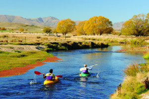
Close to Waipiata and popular for swimming, fishing and kayaking is NZ's third longest river, the 318 km Taieri River
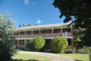
Originally called Lower Eweburn, the opening of the township’s first school saw the name changed to Waipiata, Maori for “glistening (or clear) water” referring to the nearby 318km Taieri River. The Waipiata train station was originally the disembarkation point for the 112 bed tuberculosis sanatorium.Quite literally in the middle of nowhere, this large, mainly brick complex was built in built in 1920s near the Hamiltons gold diggings and long-disappeared township. After the sanatorium closed, it was a youth detention centre and is now the religious retreat ‘En Hakkore. Well worth visiting, the road carries on to the restored Hamiltons Cemetery offering spectacular Maniototo views then to Patearoa looping back to Waipiata.
In Waipitata the railway goods shed remains along with a number of historic buildings including the library, mud brick cottages, Presbyterian and Anglican churches, Waipiata Hotel and the former rabbit processing factory.
Info
Population: 24
Komako Peonies and Cottage Garden
Tagged as: Bed & BreakfastKomako Peonies and Cottage Garden at Waipiata alongside the Otago Central Rail Trail is much more than just a night's accommodation, it really is the place to stay.
Rates:-
$95, sole booking
-
$80 for 2 or more
Peter's Farm Lodge
Tagged as: Bed & Breakfast, Historic, FarmstayWarm comfortable heritage accommodation at affordable prices.
Enjoy the ambience of a historical homestead with spectacular views over the Maniototo plain & surrounding mountain ranges. Peter's Farm Lodge was built in 1882 of mud brick and volcanic rock.
Rates:$85 per adult, $60 per child under 12 years, single room $105 per person
All guests get a free continental breakfast each morning. Fresh baked bread daily.
More Info
Tregonnings Cottage
Tagged as: Self - Contained, HistoricTregonninng cottage was built in 1880 of mud brick and schist. This quaint cottage still stands strong today with remaining features like the original H.E SHACKLOCK ORION No.1 coal range and the 5 foot 8 inches doors which lead to the three bed rooms.
Rates:$85 per adult, $60 per child under 12 years / minimum booking is $400 included occupancy of 5 people.
All guests get a free continental breakfast each morning. Fresh baked bread daily.
Waipiata Country Hotel
Tagged as: HotelStunning Accommodation, Licensed Restaurant, Bistro & Bar with Alfresco Dining... just paces from the Otago Central Rail Trail and only 10km from the Art Deco town of Ranfurly.
Rates:From $70 pp which includes a full continental breakfast. Group rates are available
More InfoWaipiata Country Hotel
Come and meet the friendly locals. Ph: 03 444 9470
Hamiltons Cemetery
Drive past the religious retreat, En Hakkore, to find Hamilton’s diggings. Carry on driving and you will find the restored Hamilton’s Cemetery with its spectacular views. This road carries on to Patearoa where you can drive in a loop back on the bottom road to Waipiata.
Historical Churches
Cycle down the main street of Waipiata, which is only about 200 meters long. You will see one very small library, an original mud brick cottage, and two historical churches (one of which is made of the same rock as the Dunedin railway station). Both are now privately owned.
Original Tuberculosis Hospital
Drive to the building complex which is used to be Tuberculosis sanatorium located near the old gold mining town of Hamiltons at the eastern base of the Rock and Pillar range. This complex then became a Youth Centre and is now a Christian religious retreat called En Hakkore which is located about 7 km from Waipiata town.
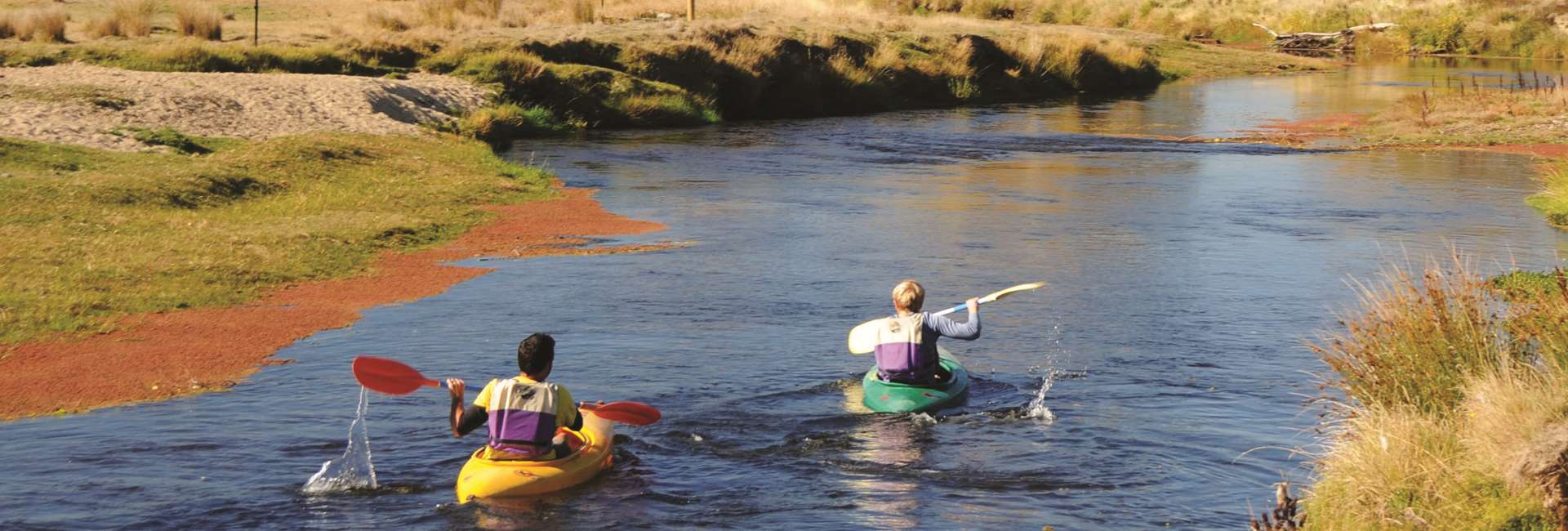
Swimming, Kayaking and Fishing at Waipiata
New Zealand’s third longest river, the 318km long Taeiri River, is close by and is popular for swimming, kayaking and fishing.
The Historic Green Bridge
To find the historic Green Bridge, cycle through Waipiata’s main street and turn left at the end of the road. Keep on the tar seal road and you will soon come to the historic Green Bridge.
Waipiata Bowling Green
The remaining hubs for the local community are the bowling green and the Waipiata Hotel.
Waipiata Man
Grab a photo with the Waipiata man which is made of steel.
Waipiata Tennis Courts
There are two tennis courts available for the general public to use.
Maniototo Rodeo
Gate Prices: Adult $15, Children 10 -15 $5, Under 10 Free, Family pass $40
Contact : Kim Parker 03 444 9158, 021 108 6508. maniototorodeo@gmail.com
When: 13th December 2025
Where : From Ranfurly head along Charlemont Street East, turn right on to Stafford Street then left onto Waipiata Road, turn left on to Barneys Lane, drive right to the end and turn right onto Waipiata-Naseby Road. Rodeo grounds are on the right.
Our Recommendation: Day 3 (start Waipiata, finish Middlemarch )
Cycling from Waipiata to Middlemarch 52 km but the good news is this part of the Rail Trail is mostly downhill.
How to return to Clyde from Middlemarch or get from Middlemarch to Dunedin does require forward planning, primarily because there is no public transport.
- Organaise with your Bike Hire company / Tour Operators to drive you back to Alexandra/Clyde or on to Queenstown ( this must be prearranged ). Clyde and Alexandra are the only Rail Trail towns Intercity goes through. Intercity Bus Timetable.
- Some Bike Hire Companies/ Tour Operators run on-demand shuttles from Middlemarch to Dunedin Airport and Dunedin city. This must be booked well in advance.
- Staying in Middlemarch for a night is definitely an option.
Your Journey on Day 3
Click on the tabs below for info on the trail and distances between them.
Waipiata
Close to Waipiata and popular for swimming, fishing and kayaking is NZ's third longest river, the 318 km Taieri River
Originally called Lower Eweburn, the opening of the township’s first school saw the name changed to Waipiata, Maori for “glistening (or clear) water” referring to the nearby 318km Taieri River. The Waipiata train station was originally the disembarkation point for the 112 bed tuberculosis sanatorium.Quite literally in the middle of nowhere, this large, mainly brick complex was built in built in 1920s near the Hamiltons gold diggings and long-disappeared township. After the sanatorium closed, it was a youth detention centre and is now the religious retreat ‘En Hakkore. Well worth visiting, the road carries on to the restored Hamiltons Cemetery offering spectacular Maniototo views then to Patearoa looping back to Waipiata.
In Waipitata the railway goods shed remains along with a number of historic buildings including the library, mud brick cottages, Presbyterian and Anglican churches, Waipiata Hotel and the former rabbit processing factory.
Info
Population: 24
Komako Peonies and Cottage Garden
Tagged as: Bed & BreakfastKomako Peonies and Cottage Garden at Waipiata alongside the Otago Central Rail Trail is much more than just a night's accommodation, it really is the place to stay.
Rates:-
$95, sole booking
-
$80 for 2 or more
Peter's Farm Lodge
Tagged as: Bed & Breakfast, Historic, FarmstayWarm comfortable heritage accommodation at affordable prices.
Enjoy the ambience of a historical homestead with spectacular views over the Maniototo plain & surrounding mountain ranges. Peter's Farm Lodge was built in 1882 of mud brick and volcanic rock.
Rates:$85 per adult, $60 per child under 12 years, single room $105 per person
All guests get a free continental breakfast each morning. Fresh baked bread daily.
More Info
Tregonnings Cottage
Tagged as: Self - Contained, HistoricTregonninng cottage was built in 1880 of mud brick and schist. This quaint cottage still stands strong today with remaining features like the original H.E SHACKLOCK ORION No.1 coal range and the 5 foot 8 inches doors which lead to the three bed rooms.
Rates:$85 per adult, $60 per child under 12 years / minimum booking is $400 included occupancy of 5 people.
All guests get a free continental breakfast each morning. Fresh baked bread daily.
Waipiata Country Hotel
Tagged as: HotelStunning Accommodation, Licensed Restaurant, Bistro & Bar with Alfresco Dining... just paces from the Otago Central Rail Trail and only 10km from the Art Deco town of Ranfurly.
Rates:From $70 pp which includes a full continental breakfast. Group rates are available
More InfoWaipiata Country Hotel
Come and meet the friendly locals. Ph: 03 444 9470
Hamiltons Cemetery
Drive past the religious retreat, En Hakkore, to find Hamilton’s diggings. Carry on driving and you will find the restored Hamilton’s Cemetery with its spectacular views. This road carries on to Patearoa where you can drive in a loop back on the bottom road to Waipiata.
Historical Churches
Cycle down the main street of Waipiata, which is only about 200 meters long. You will see one very small library, an original mud brick cottage, and two historical churches (one of which is made of the same rock as the Dunedin railway station). Both are now privately owned.
Original Tuberculosis Hospital
Drive to the building complex which is used to be Tuberculosis sanatorium located near the old gold mining town of Hamiltons at the eastern base of the Rock and Pillar range. This complex then became a Youth Centre and is now a Christian religious retreat called En Hakkore which is located about 7 km from Waipiata town.
Swimming, Kayaking and Fishing at Waipiata
New Zealand’s third longest river, the 318km long Taeiri River, is close by and is popular for swimming, kayaking and fishing.
The Historic Green Bridge
To find the historic Green Bridge, cycle through Waipiata’s main street and turn left at the end of the road. Keep on the tar seal road and you will soon come to the historic Green Bridge.
Waipiata Bowling Green
The remaining hubs for the local community are the bowling green and the Waipiata Hotel.
Waipiata Man
Grab a photo with the Waipiata man which is made of steel.
Waipiata Tennis Courts
There are two tennis courts available for the general public to use.
Maniototo Rodeo
Gate Prices: Adult $15, Children 10 -15 $5, Under 10 Free, Family pass $40
Contact : Kim Parker 03 444 9158, 021 108 6508. maniototorodeo@gmail.com
When: 13th December 2025
Where : From Ranfurly head along Charlemont Street East, turn right on to Stafford Street then left onto Waipiata Road, turn left on to Barneys Lane, drive right to the end and turn right onto Waipiata-Naseby Road. Rodeo grounds are on the right.
Waipiata to Kokonga Distance: 10.5 km
- The 97m long and 6m high Taieri River Rail Bridge is the Rail Trail's only crossing of the Taieri River, New Zealand's fourth longest river.
- A short distance along the trail from the bridge is one of the only “freedom camping areas” on the Otago Central Rail Trail. No running water available. No fires.
- Catch a trout for tea from the banks of the Taieri River.
- Read the display boards about the naturally formed Lake Taieri which was drained in the 1940’s.
- Observe the pitted volcanic rocks blown from the extinct Flat Cap Volcano beside the trail.
- The Waipiata to Kokonga Road runs parallel to the Rail Trail at one point and physically crosses the Trail further down the line, known locally as Carey’s Crossing.
- Further along is the town of Kokonga with a small settlement of houses below the trail.
- The Gangers shed at Kokonga can be also be accessed from State Highway 87 (sign-posted 'Rail Trail Road').
- The Kokonga Railway Station and Goods Shed have been removed but the concrete sided platform still remains.


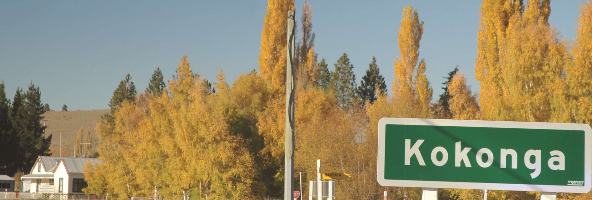
Kokonga
Overlooking the Taieri River with views of the Rock and Pillar Mountain range and the Kakanui Mountains, Kokonga offers beautiful scenery and a peaceful atmosphere
Kokonga (Maori meaning “bending river”), is a tiny, quiet township that sprung up in the 1890s as a noisy, busy railway construction settlement. From the Kokonga Station site, railway wagons were lowered down rails to the Taieri to be loaded with river gravel. Winched back up, the wagons were hauled by locomotive to the head of line construction, their loads to be ballast for supporting sleepers and rails. A bucket cable system was also used to get gravel up from the Taieri River. Kokonga still has remains of a church, school and store. Alongside the trail north of Kokonga is the historic Kyeburn-Kokonga Cemetery and World War 1 memorial. Between Waipiata and Kokonga, trailside panels point out where basalt was taken for the Dunedin Railway Station, reputed to be NZ’s most photographed building.
Info
Population: 5
Kokonga Lodge
Tagged as: Bed & Breakfast, EnsuiteFeel the difference when you arrive at Kokonga Lodge. Situated in a peaceful rural setting across the road from the Taieri River and with direct access to the world famous, Otago Central Rail Trail.
Rates:$340.00 double/twin
More InfoFishing at Kokonga
There is easy access for fishing to the Taieri river from SH 87.

Kokonga - Dasiybank Car Park 4km
- From Kokonga the Trail runs adjacent to State Highway 87. Take time to admire the impressive Kakanui Mountains to the east.
- The Daisybank car park is another convenient place to meet up with support vehicles. It is clearly signposted on State Highway 87 and on the Rail Trail itself.
Daisy Bank Car Park - Tiroiti 4 km
- Look and also listen carefully for traffic before crossing the sweeping corner of State Highway 87 at Daisybank.
- You are now entering the dramatic terrain of the Upper Taieri Gorge. The many cuts and fills that make the trail easy for cyclists today show just how difficult it was to construct the Otago Central Railway back in the days of the pick, shovel and wheelbarrow.
- A remaining feature of the railway’s early days is the Red Dwarf Gangers Shed. Poking your head out of the shed’s little window is a fun photo opportunity.
- Not far from here is the Daisybank Freedom Camping site. No open fires are permitted during the closed season. No running water but there is a DOC toilet. Contact DOC for more information. It is recommended hopping off your bike to walk through the pines to the banks of the river at the camping area. Depending on the time of year, take a refreshing plunge in the Taieri.
- A couple of km’s later at the Tiroiti station site is a railway red gangers’ shed and information kiosk. Between 1895 and 1897 there was a major railway construction camp at Tiroiti.
Tiroiti - Hyde 6.5 km
- Not far from Tiroiti is the 40 metres long, 7 metres tall Cap Burn Railway Bridge. We recommend taking time to examine the historic dressed stone abutments and iron trusses as well as the original sleepers and railway lines. .
- Next you’ll cross the 91 metres long and 32 metres high Prices Creek Viaduct. Built of concrete and steel in 1963 to replace a wooden bridge, it was the last major construction project before the railway closed. Cyclists should be aware of strong wind gusts when crossing the viaduct.
- An alternative route for horseback riders is signposted on both ends of the viaduct.
- The attractions keep coming with the 151 metres long slightly curved Prices Creek (Hyde) Tunnel, the only completely bricked tunnel on the Rail Trail.
- Close to the tunnel entry a walkway leads down to the Taieri River for a close up view of the Hyde diversion tunnel. By diverting a section of river, miners believed gold could be plucked from the dry river bed. Unfortunately none was found. The walkway offers stunning scenery, interesting history, and great photo opportunities (highly recommended).
- After the Prices Creek (Hyde) Tunnel, a gentle gradient takes you to the township of Hyde where there is a public car park, information kiosk and food and refreshment.


Hyde
The perfect pause for Rail Trailers to rest and refuel
Hyde was originally called ‘Eight Mile’ because of its distance from the Hamiltons Gold Mine where during the gold rush era many of the town’s residents found work. At Hyde itself, extensive mineral deposits were discovered for glass making and fine pottery. A china clay pit is still worked to this day. Hyde is also home to Cooks Transport where a 24 self-service RD petrol and diesel is open to the public. As remote as Hyde may seem, its main street, Eton Street, is in fact State Highway 87 that runs from Highway 85 at Kyeburn (15km east of Ranfurly) to State Highway 1 at Mosgiel. For Rail Trailers, Hyde is perfectly positioned to rest and refuel as the nearest food and refreshments are 29km to the north at Waipiata and 27km south in Middlemarch.
With no suitably level ground in Hyde, the railway station had to be located 2km away on a flat area big enough to on and offload wagons. The original station building is owned by the Otago Central Rail Trail Trust and open to the public to explore railways memorabilia. A few kilometres south of the station on June 1943, of the 113 passengers on board the Cromwell to Dunedin Express 21 lost their lives when the train failed to take a bend. Hyde is also an ideal step off point for a visit to historic Macraes Flat and the enormous 24/7 Macraes gold mine.
Info
Population: 21Fishing at Hyde
You can get to a good location from the Macraes road bridge. The Taieri river has brown trout in plentiful supply.

Hyde Diversion Tunnel
Early European miners peppered the Taieri river with gold and then on sold the mining rights to some Chinese gold miners who were led to believe it was a substantial claim. The Chinese gold miners built a tunnel to divert the river and make it easier to mine the gold. Whilst the diversion tunnel was laboriously and successfully constructed to the Chinese miners dismay the effort was in vain when the “planted” gold ran out shortly afterwards.

Hyde Station Site
At the Hyde Station Site take time to admire the old station building, which has recently been purchased by the Otago Central Rail Trail Trust and is open to the public. Although this was the main station for Hyde, there was a passenger halt at the township where the line crossed the main road. This halt was closed in 1978.

Hyde to Middlemarch Distance: 27 km
- The section from Hyde to Middlemarch can be prone to strong winds, especially over spring and summer seasons. Generally though, winds are from the north which means a helping push. But should there be a head wind, you can take a break to rest and read the information panels in four gangers’ sheds:- Scrub Burn, Rock and Pillar Access, Strath Taieri and Rock and Pillar Station .
- Due to a lack of flat land at Hyde, the station is 2km down the line. Here is a well maintained station building and a number of original stock wagons. The station site also has road access from State Highway 87.
- Past the Hyde Station is ‘Straw Cutting’, site of the Hyde railway derailment that on June 4th, 1943 claimed 21 lives and injured 46. Around 200 metres along the trail from here is a memorial area with a commemorative stone cairn. This also makes a convenient meeting place for Rail Trail cyclists and support vehicles.
- As you approach the flatter farmland of the Strath Taieri Plain you’ll ride over Five Mile Creek, the rail’s last substantial bridge.
- The Strath Taieri is flanked by the majestic Rock and Pillar Range to the nor-west and Taieri Ridge to the south-east.
- Another good meeting point for support vehicles and cyclists is at the Rock and Pillar Gangers Shed where the Rail Trail crosses State Highway 87.
- Regardless of wind direction, it is rewarding sight to see Middlemarch getting closer and closer, and where fine food, beverages and country hospitality await you.
- Congratulations. You’ve done it. 153km.


Middlemarch
Depending on which direction you want to go, Middlemarch is either at the beginning or end of your Otago Central Rail Trail experience
Scenery alone is enough to make Middlemarch a must stay. Located at the southern end of the Strath Taieri Plain, this rural centre of around 300 is dominated by the towering bulk of the Rock and Range (1450m) to the west, the Taieri Ridge to the east and to the south, the Maungatua (892m) Range. Little wonder Peter Jackson featured this scenery in ‘The Hobbit’. Just a taster of points of interest in and around Middlemarch is Sutton Salt Lake, the only inland salt lake in New Zealand, the remains of a 1873 gold mining submarine, albeit an ill-fated venture, a sheep yard built of schist rock, interesting public artwork, fish waiting to be caught in the Taieri River, southern hospitality at its warmest and lots more besides.

Annandale Bed & Breakfast
Tagged as: Bed & Breakfast, HistoricAnnandale Bed & Breakfast is located in sunny Middlemarch offering stunning mountain views.
This character home is perfect to relax & reflect on your bike ride or prepare for your next days adventures. Conveniently located just 400 m from the Otago Rail Trail at Middlemarch and is close to the Rock & Pillar Ranges for day walks. A courtesy Car is available to & from Hyde if there is no accommodation available in Hyde. Meals came be provide at Annandale or its just 100 metre to the Strath Taieri Hotel.
queen/Single $190.00 per night
Additional single ( 3 in a room) $$50
Self Catered Breakfasts included in the prices
More Info
Strath Taieri Hotel
Tagged as: HotelThe Strath Taieri Hotel in Middlemarch is a friendly country hotel with that traditional atmosphere - "the genuine article". Located opposite the Middlemarch Railway Station and just 200 m from the beginning of the Otago Central Rail Trail, we offer great food, great entertainment, great ambience - be sure to visit us!
Rates:Double room 2x guests $85 per night.
Single room 1x Guest $65 per night.
Rooms have shared facilities, guest TV Lounge available.
Complimentary Tea & Coffee. Continental Breakfast as required.
More InfoKissing Gate Café
Great food awaits you. Located on State Highway 87 towards Dunedin.
Ph: 03 464 3224.

Maggie's
Groceries, milkshakes, cold drinks, ice cream. 16 Aberafon St. Open every day 9 am - 7:30 pm.
Ph: 03 464 3611

Strath Taieri Hotel
Located directly opposite the train station on Snow Ave, The Middlemarch Hotel offers two bars with food and a great atmosphere. Rail Trail photos can be found in the bistro area.
Ph: 03 464 3800.

Browse the town
Browse the town and you will find two churches, the war memorial, small grocery shop, and sheep and horses grazing on empty sections.

Middlemarch Bowling Green
Middlemarch Bowling Club. Contact: Nola Tisdall, Ph: 03 464 3883

Middlemarch Golf Course
Garthmyl Rd. Ph: 03 464 3867

Middlemarch lockup
Behind Jailhouse accommodation is the historic 2 cell lockup (1863 -1947). Open to the public.

Middlemarch Museum
When the gold rush was on in 1873, miners were desperate to keep working even over the cold winter months when the Taeiri River was running high and ice cold. It was decided the best plan of attack was to build a submarine which could be lowered into the Taeiri River. With an open area at the bottom of the submarine, the ambitious miners could work their pans and hopefully make a fortune. Tragically the oxygen supply run out and 3 of the 4 miners died on the first launch. The museum also has farming and war memorabilia which is located on Aberafor Street just around the corner from Cycle Surgery. Ph: 03 464 3853

Middlemarch Swimming Pool
Swimming pool is located in the Middlemarch school grounds and is the complex used by the Middlemarch Swimming Club. Contact: Steph Macaulay. Ph: 03 464 3366

Middlemarch Tennis Courts
For a small rural town, Middlemarch has done very well to maintain its public tennis courts available for public use.

Original Railway Station Buildings
All the original railway station buildings have been very well maintained. It is arguably the best example of how things were when the line was in its glory days. Many photo opportunities are located in this historic area which is 100 meters from the Otago Central Rail Trail start/finish point.

Rock and Pillow Range
You can view the impressive Rock and Pillow Range from the township (snow caped over winter months).

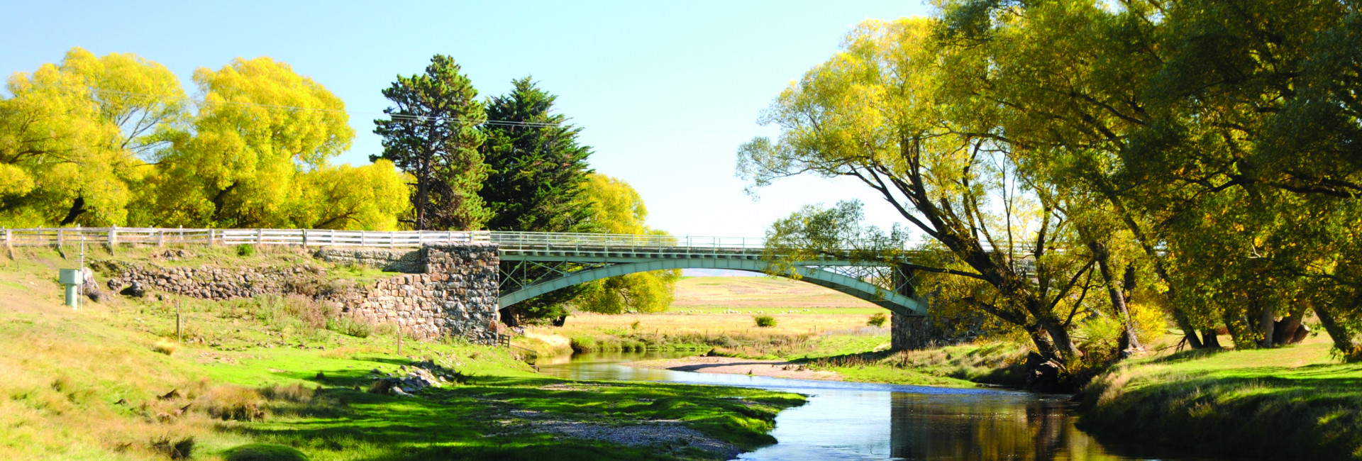
The Sutton Salt Lake
The Sutton Salt Lake is New Zealand's only inland salt lake, with water about half as salty as seawater. The Sutton Suspension Bridge which crosses the Taieri River has impressive stone abutments is located on Harcus Road. The Sutton Military Campwas used for artillery training purposes between 1913 and 1955.There was once accommodation for 3000 troops. The historic slab stone sheep yards located on Murrays Road is also worth a visit. Rail Trail Planner providing detailed tours, transport and scenic 4 wheel driving excursions. Ph: 03 464 3755 or 027 251 0049.

Strath Taieri A&P Show
Cattle, sheep, wool, dog trials, showjumping, in hand horses, hunter round the ring, led rein,small ponies. Great prizes for High Jump and Round the Ring, Supreme Champions for the Horses, Horses do not have to have height certificates, classing is run under Pony Club Guidelines, and are not eligible for Horse of the Year Classes. Home Industries Champions. Spouse Carrying competition and Lawn Mower Races as well.
Where : Showgrounds, Browns Rd, Middlemarch
When : 22nd March 2026
Secretary: Tess Gibb
Email: strathtaierishow@gmail.com